- -15%
- Out-of-Stock


Search here...
Stay on track through all kinds of adventures.

Stay on track through all kinds of adventures.
The price has not been reduced in the last 30 days. The recommended price is set by the manufacturer and is shown for reference only.

FREE SHIPPING IN ITALY FROM 129,99 EUROS*

100% SECURE CHECKOUT

N.1 in Italy in the Bike and E-Bike Shops
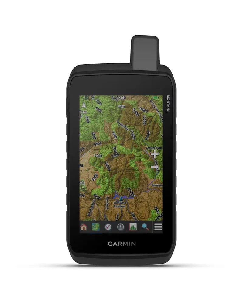
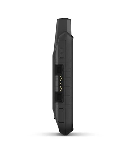
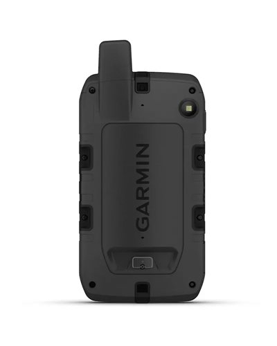
With routable mapping for roads and trails, the Montana 710 handheld brings advanced outdoor features into a sturdy 5-inch format that’s ideal for navigation on foot, bike, kayak, ATV and more.
• LARGE 5-INCH GLOVE-FRIENDLY TOUCHSCREEN
• PRELOADED ROUTABLE TOPOGRAPHIC MAPS WITH LANDMARKS
• MEETS MIL-STD 810 FOR THERMAL, SHOCK, WATER AND VIBRATION
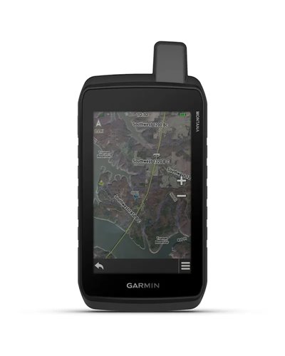
• SATELLITE IMAGERY SHOWS VIVID OVERHEAD VIEWS OF YOUR ROUTE
• SUPPORTS OUTDOOR MAPS+ FOR PREMIUM MAPPING (SOLD SEPARATELY)
• PLAN AND REVIEW TRIPS WITH THE GARMIN EXPLORE™ SMARTPHONE APP
RUGGED BY DESIGN
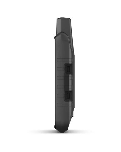
This durable, water-resistant handheld is tested to meet MIL-STD 810 for thermal, shock, water and vibration. It features a glove-friendly 5-inch touchscreen and is compatible with a variety of robust mounting solutions (sold separately) to best suit your activities.
TOPOACTIVE MAPS
To navigate your adventures, use preloaded topographical maps. View terrain contours, elevations, coastlines, rivers, landmarks and more.
SATELLITE VIEWS
Access subscription-free, high-resolution satellite imagery with direct-to-device downloads over Wi-Fi® connectivity. See photorealistic overhead views of routes and surrounding terrain, and easily create waypoints based on landmarks.
ADDITIONAL MAPS
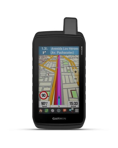
With 32 GB of onboard memory, you can download even more maps, such as City Navigator® maps for your drive or BlueChart® g3 charts for the water (sold separately).
OUTDOOR MAPS+
Add a subscription to Outdoor Maps+ (sold separately), and get ongoing access to a wide variety of premium mapping content and regular updates sent right to your Garmin device via Wi-Fi technology.
GARMIN EXPLORE™ APP
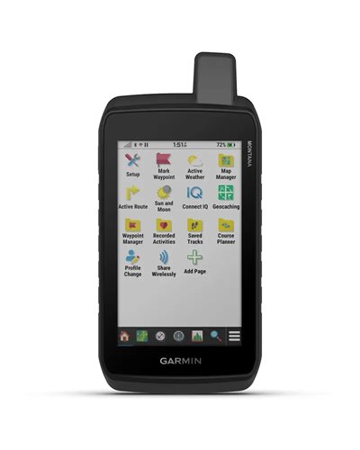
Pair with the Garmin Explore app to plan and review trip data, plus manage your waypoints, courses and activities.
TRACK YOUR ADVENTURES ON ANY TERRAIN
NAVIGATION FEATURES
MULTI-GNSS SUPPORT
Access to GPS and Galileo satellite networks enables Montana 710 to track in more challenging environments than GPS alone.
ABC SENSORS
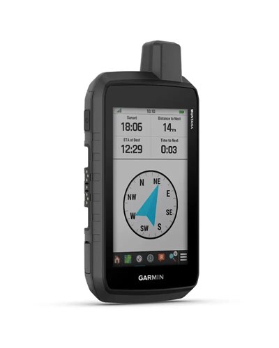
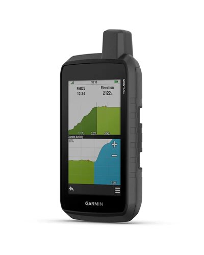
Navigate your next trail with ABC sensors, including an altimeter for elevation data, barometer to monitor weather and 3-axis electronic compass.
ACTIVE WEATHER
Access up-to-date active weather forecasts via the Garmin Connect™ app on your compatible smartphone
DOG TRACKING
For hunters and trainers, this Montana handheld syncs with your compatible Astro® or Alpha® series handhelds to help track sporting dogs in the field.
WIKILOC TRAILS
This preloaded app lets you easily download hiking, cycling and other Wikiloc trails shared by outdoor enthusiasts like you. Get a free 60-day Wikiloc Premium trial to try this and other exclusive features. Learn more.
ADVENTURE FEATURES
EXPEDITION MODE
Trek far and wide off-grid. Use expedition mode, an ultralow-powered GPS reference, to keep Montana tracking for more than 2 weeks between recharges.
BATTERY OPTIONS
An internal lithium-ion battery pack provides up to 24 hours of battery life in GPS mode and recharges with a standard USB-C® cable.
VEHICLE MOUNTS
A variety of Montana handheld-compatible mounts (sold separately) lets you adapt your navigator for use on ATVs, boats, cars, motorcycles, motorhomes or other vehicles.
1 - When paired with a compatible smartphone.
IN THE BOX:
Montana® 710
High capacity lithium-ion battery pack
USB cable
Documentation
Data sheet
No customer reviews for the moment.
Hikers and cyclists on mixed routes
Designed for those using an outdoor navigator on roads and trails, with TopoActive maps, Multi-GNSS support and a 5 inch touchscreen suitable for glove use.
Those working in demanding environments
Suitable for those seeking a robust, waterproof device compliant with the MIL-STD 810 standard, with protection against extreme temperatures, impacts, water and vibration.
Those planning long and remote outings
Indicated for those who want extended autonomy in Expedition mode, additional maps, weather data and route management through Garmin Explore™.
Ideal
Hiking and cycling on marked trails
TopoActive maps, ABC sensors and Multi-GNSS support help with navigation on mixed routes.
Mappe TopoActive · Sensori ABC · Multi-GNSS
Very suitable
Hiking in challenging environments
The robust, waterproof construction, with MIL-STD 810 compliance, is designed for extreme temperatures, impacts, water and vibration.
MIL-STD 810 · Impermeabile · Temperature estreme
Very suitable
Trips planned from a smartphone
With Garmin Explore™, travel data can be planned and reviewed, as well as waypoint, route and activity management.
Garmin Explore™ · Waypoint · Percorsi
Suitable
Use on quad bikes, motorbikes or other vehicles
Compatibility with dedicated mounts allows the device to be adapted to different mounting solutions, sold separately.
Supporti compatibili · Montaggio · Quad
Experienced outdoor user
Those active across multiple disciplines
It offers Multi-GNSS support, TopoActive maps and ABC sensors. This helps with orientation even in remote areas.
The battery lasts up to 24 hours in GPS mode and more than 2 weeks in Expedition mode.
Yes, it is robust and waterproof, and compliant with the MIL-STD 810 standard. It is designed for extreme temperatures, impacts, water and vibration.
Yes, it has a 5 inch touchscreen suitable for use with gloves.
Yes, with Wi-Fi® and internal memory, additional maps can be downloaded, including Outdoor Maps+ and other compatible maps.
Yes, it is compatible with a compatible smartphone and with the Garmin Explore™ app for planning and reviewing trips.
Information prepared by the BSA team with the support of AI, based on the manufacturer's specifications.