- -10%


Search here...
Stay on track through all kinds of adventures.

Stay on track through all kinds of adventures.
The price has not been reduced in the last 30 days. The recommended price is set by the manufacturer and is shown for reference only.

FREE SHIPPING IN ITALY FROM 129,99 EUROS*

100% SECURE CHECKOUT

N.1 in Italy in the Bike and E-Bike Shops
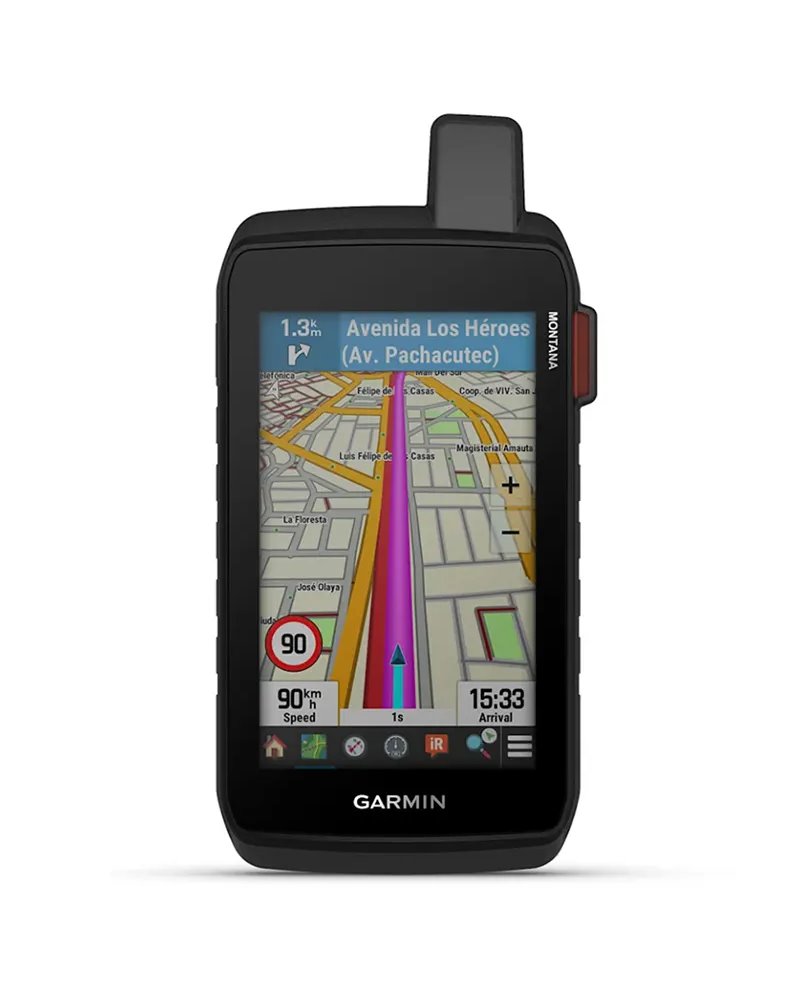
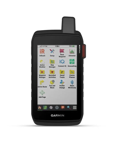
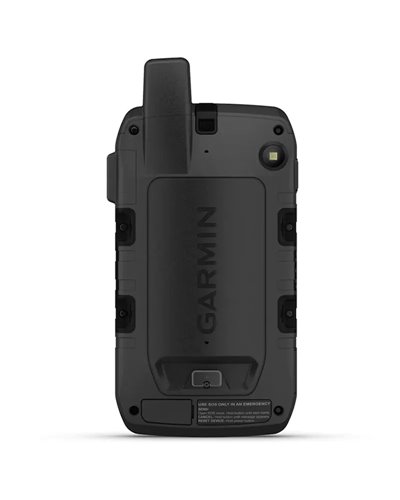
Get advanced outdoor features — plus inReach technology for two-way messaging and interactive SOS alerts1 — in a rugged 5-inch format that’s ideal for navigation on foot, bike, kayak, ATV and more.
• LARGE 5-INCH GLOVE-FRIENDLY TOUCHSCREEN
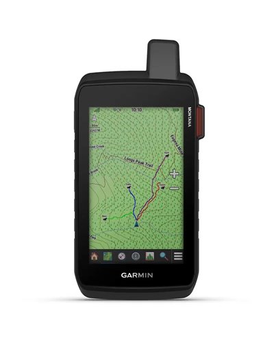
• PRELOADED ROUTABLE TOPOGRAPHIC MAPS WITH LANDMARKS
• STAY IN TOUCH WITH INREACH MESSAGING AND 24/7 SOS1
• MEETS MIL-STD 810 FOR THERMAL, SHOCK, WATER AND VIBRATION
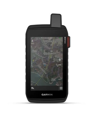
• SATELLITE IMAGERY SHOWS VIVID OVERHEAD VIEWS OF YOUR ROUTE
• SUPPORTS OUTDOOR MAPS+ FOR PREMIUM MAPPING (SOLD SEPARATELY)
GLOBAL CONNECTIVITY
With an active inReach subscription, you can stay connected even when your adventures go off grid. Instead of relying on smartphone coverage, now your messages, SOS and tracking are transferred via the 100% global Iridium® satellite network1.
RUGGED BY DESIGN
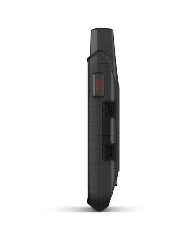
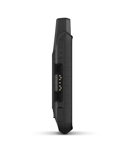
This durable, water-resistant handheld is tested to meet MIL-STD 810 for thermal, shock, water and vibration. It features a glove-friendly 5-inch touchscreen and is compatible with a variety of robust mounting solutions (sold separately) to best suit your activities.
TOPOACTIVE MAPS
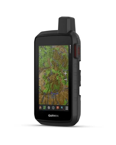
To navigate your adventures, use preloaded topographical maps. View terrain contours, elevations, coastlines, rivers, landmarks and more.
SATELLITE VIEWS
Access subscription-free, high-resolution satellite imagery with direct-to-device downloads over Wi-Fi® connectivity. See photorealistic overhead views of routes and surrounding terrain, and easily create waypoints based on landmarks.
OUTDOOR MAPS+
Add a subscription to Outdoor Maps+ (sold separately), and get ongoing access to a wide variety of premium mapping content and regular updates sent right to your Garmin device via Wi-Fi technology.
GARMIN EXPLORE™ APP
Pair with the Garmin Explore app to plan and review trip data, plus manage your waypoints, courses and activities.
EXPLORE THE WORLD. STAY CONNECTED TO HOME
INREACH FEATURES
TWO-WAY MESSAGING
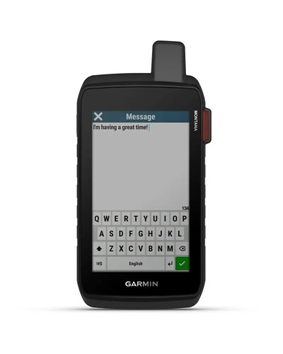
Exchange text messages with loved ones back home, or communicate via inReach device to inReach device in the field1.
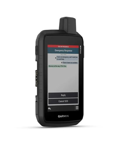
INTERACTIVE SOS
In case of emergency, trigger an interactive SOS message to Garmin Response℠, a 24/7-staffed professional emergency response coordination centre1.
INREACH WEATHER
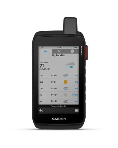
Available inReach weather forecast service provides detailed updates directly to your Montana handheld or paired devices, so you’ll know what to expect en route1.
LIVE TRACKING
Using your live tracking page, followers can see your progress, ping your device to see your GPS location and exchange messages during your trip1.
NAVIGATION FEATURES
MULTI-GNSS SUPPORT
Access to GPS and Galileo satellite networks enables Montana 710i to track in more challenging environments than GPS alone.
ABC SENSORS
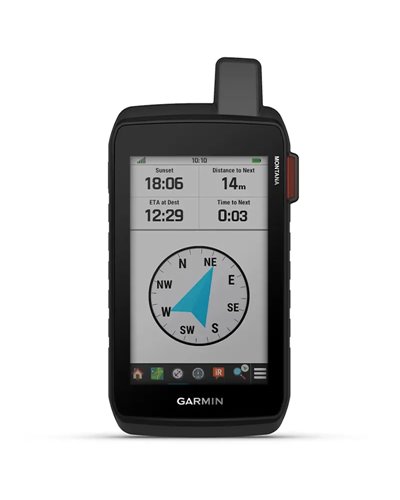
Navigate your next trail with ABC sensors, including an altimeter for elevation data, barometer to monitor weather and 3-axis electronic compass.
CITY NAVIGATOR® MAPS
Seamlessly transition from trails to road navigation with preloaded European City Navigator street mapping, which guides your drive with easy-to-follow turn-by-turn directions.
ADDITIONAL MAPS
With 32 GB of onboard memory, you can download even more maps, such as BlueChart® g3 charts for the water (sold separately).
ACTIVE WEATHER
Access up-to-date active weather forecasts via the Garmin Connect™ app on your compatible smartphone
DOG TRACKING
For hunters and trainers, this Montana handheld syncs with your compatible Astro® or Alpha® series handhelds to help track sporting dogs in the field.
WIKILOC TRAILS
This preloaded app lets you easily download hiking, cycling and other Wikiloc trails shared by outdoor enthusiasts like you. Get a free 60-day Wikiloc Premium trial to try this and other exclusive features. Learn more.
ADVENTURE FEATURES
EXPEDITION MODE
Trek far and wide off-grid. Use expedition mode, an ultralow-powered GPS reference, to keep Montana tracking for more than 2 weeks between recharges.
BATTERY OPTIONS
An internal lithium-ion battery pack provides up to 24 hours of battery life in GPS mode and recharges with a standard USB-C® cable.
VEHICLE MOUNTS
A variety of Montana handheld-compatible mounts (sold separately) lets you adapt your navigator for use on ATVs, boats, cars, motorcycles, motorhomes or other vehicles.
1 - Active satellite subscription required. Some jurisdictions regulate or prohibit the use of satellite communication devices. It is the responsibility of the user to know and follow all applicable laws in the jurisdictions where the device is intended to be used.
IN THE BOX:
Montana® 710i
High capacity lithium-ion battery pack
USB cable
Documentation
Data sheet
No customer reviews for the moment.


Hikers and bikers in remote environments
Designed for people moving outdoors who need navigation, tracking and communication even far from mobile coverage.
Users operating in demanding conditions
Suitable for those looking for a device resistant to extreme temperatures, impacts, water and vibrations, with a waterproof body and MIL-STD 810 standard.
Those who want a Garmin navigator with satellite functions
Indicated for users of the Garmin ecosystem who want multi-GNSS support, preloaded topographic maps and inReach two-way messaging.
Ideal
Trekking and cycle touring on remote routes
Support for GPS, Galileo and preloaded topographic maps helps with route reading and terrain reference.
Topographic maps · GPS and Galileo · Outdoor
Ideal
Excursions with satellite communication
Two-way messaging and inReach interactive SOS alerts allow contact even outside mobile coverage.
Two-way messaging · Interactive SOS · Iridium satellite network
Very suitable
Use in environments exposed to rain and vibrations
The waterproof construction and compliance with the MIL-STD 810 standard are designed for harsh conditions and continuous outdoor use.
Waterproof · MIL-STD 810 · Vibrations
Suitable
Navigation on vehicles and dedicated mounts
Compatibility with a range of solid mounting solutions allows use on different vehicles, according to the mounts provided.
Compatible mount · Outdoor · Garmin
Technical hiker
Sport user who wants contact and safety
It supports GPS, Galileo and multi-GNSS. In practice, it helps to detect position even in more remote areas.
Battery life reaches up to 24 hours in GPS mode and more than 2 weeks in Expedition mode.
Yes, it is waterproof and complies with the MIL-STD 810 standard. This indicates resistance to extreme temperatures, impacts, water and vibrations.
It includes two-way messaging and interactive SOS alerts via inReach. An active satellite subscription is required.
It has preloaded topographic maps and satellite imagery. The maps help to read the route, altitude and landmarks.
It is compatible with Garmin. This compatibility concerns integration with the brand’s ecosystem.
Charging is via USB-C® cable. The sheet also indicates Wi‑Fi® connectivity and the Iridium® satellite network.
Information prepared by the BSA team with the support of AI, based on the manufacturer's specifications.